
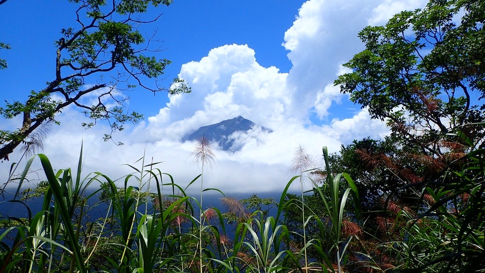
The Taroko National Park is one of the nine national parks in Taiwan. This one, created in 1986, is 920 square kilometer and its mountains can reach over 3000 meters high – its main peak, Mount Nanhu is actually 3742 meters high and it does snow there during Winter time (yeah I know, it’s also hard for me to imagine snow in Taiwan!)
The mountains of Taroko seems to rise directly from the Pacific Ocean on its easternmost side and constitutes the northern part of the Central Mountain Range on its westernmost side.
(Lis cet article en Français, bébé!)
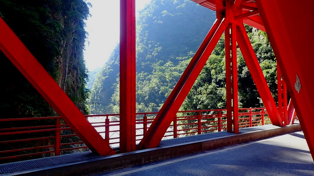
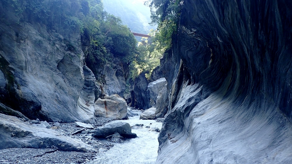
What’s very peculiar about Taroko is its wonderful gorge carved by the Liwu River into the marble. Some sections of the gorge are so narrow it’s surreal. The cliffs are steep, the rock folds impressive and glancing up or down is quite a unique experience.
Taroko is also home to an aboriginal tribe: the Truku tribe. In 1914, when the Japanese were about to take control of the land of Taroko, the Truku tribe fought hard to protect their land and properties. However, they were outnumbered and their weapons were not as good as the Japanese’s ones so they finally surrendered after 3 months of battle.
TABLE OF CONTENTS
(Because this post is seriously too long)
- INTRODUCTION TO THE TAROKO NATIONAL PARK
- GOOD TO KNOW
- MY 6 FAVORITE TRAILS
- SOME OTHER TRAILS WORTH THE WALK
- ON THE WAY
- AROUND TAROKO
INTRODUCTION TO THE TAROKO NATIONAL PARK
-
WHEN TO GO?
Taroko National Park can be visited all year round. However, from May to September, there could be heavy rain falls, as well as typhoons, causing landslides and the closure of some trails. But that mustn’t stop you! Even on the rainy season, the rain will start approximately around 16:00 or 17:00 which gives you all the time you need to walk some trails.
-
HOW TO GET THERE?
- By Public Transport:
The Taroko Shuttle Bus departs from Hualien Train Station almost every hour and stops at the main spots of the National Park until Tianxiang. Inside the National Park, several buses, including the 302, will stop at the different touristic sites and will depart from Xincheng.
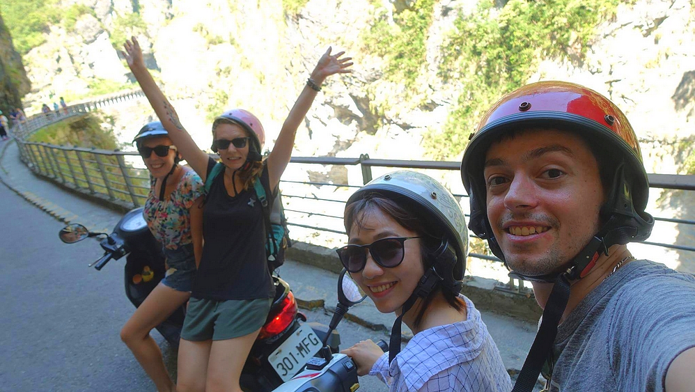
- By car/scooter:
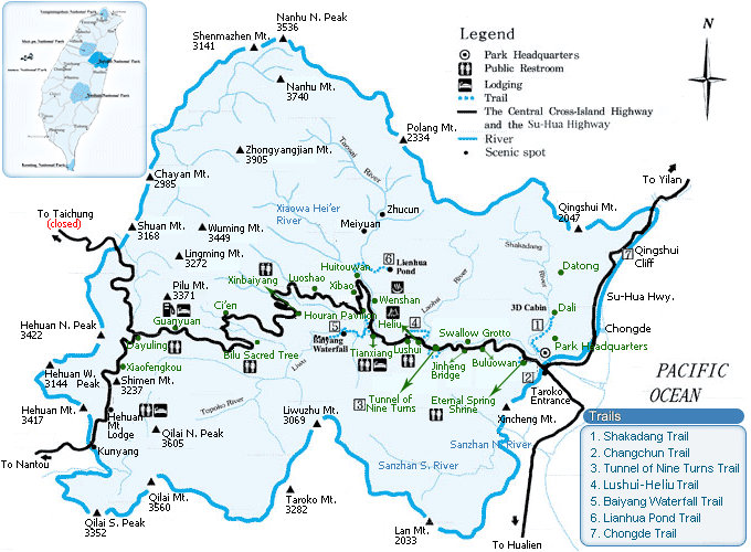
Driving a car or a scooter is definitely the fastest and most convenient way around Taroko. You can stop everywhere you want, whenever you want, and even go further past Tianxiang, the Shuttle Bus terminus. Be careful though, there are not that many gas station in the park – bringing a map of Taroko National Park is definitely a must.
-
WHAT TO BRING IN MY BACKPACK?
Inside the National Park, there are not that many places providing convenient stores, food, water or even gasoline. On hot days, you’d better pack up loads of water as well as a picnic and check on the map places where you could stop to refill. Be sure to bring sunscreen, sunglasses, a hat, good shoes but also a light raincoat in case the rain starts while you’re still hiking. And obviously, bring your camera, you’re going to take shitloads of pictures!
Be sure to bring sunscreen, sunglasses, a hat, good shoes but also a light raincoat (like those yellow poncho that you can find in the convenient stores) in case the rain starts while you’re still hiking (yeah, that happened to me as well). And obviously, bring your camera, you’re going to take shitloads of pictures!
GOOD TO KNOW
-
TRAIL CONDITIONS
Since the Taroko National Park is subject to impressive weather changes and that the terrain is highly unstable and prone to earthquakes, some trails are permanently closed, some trails are partially closed and some trails are in bad conditions. From one day to another, depending on the rain falls, landslides or rock falls, the trails conditions might change. So before heading to Taroko, be sure to check out the trail’s conditions on the website to make sure the trails you wanted to hike are actually opened:
HIKING PERMITS
Some hikes like the famous Zhuilu Old Road requires permits, that you need to apply for at least 3 days before you go. You can apply online, through the Taroko website, and you’ll need to have a passport number, a local phone number but also a Taiwanese emergency contact who’ll be the Person on Duty Contact.
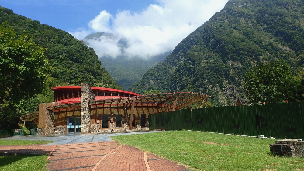
You also need to apply for a mountain entry permit from the National Police Agency – which is located at the Visitor Center. It’s also possible to apply online a few days in advance, although I couldn’t find the English version of the website:
APPLY FOR YOUR (POLICE) MOUNTAIN PERMIT
When you have your permits you need to pay a fee (200NT$ for the Zhuilu Old Road) at the Tollbooth Station.
DANGEROUS ANIMALS
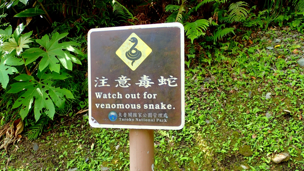
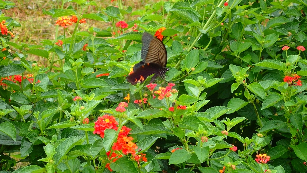
While hiking some trails, you’ll stumble upon various signs warning you about dangerous animals that can be found along the way. No need to say there are huge spiders almost everywhere (welcome to Taiwan, baby) but they look pretty harmless – although I certainly won’t recommend starting to play with their huge spider webs.


But there are also giant hornets and poisonous snakes in Taroko, and I even encountered a freaking cobra on one of my hikes. So, be careful, wear long pants, and make some noise while walking – either with a walking stick or by singing at the top of your lungs. Having some insect repellent would also make your hikes more enjoyable so the mosquitoes won’t be feeding continuously on your fresh tourist’s blood.


MY 6 FAVORITE TRAILS
-
DEKALUN-DALI TRAIL (3.5 km) / DEKALUN-DALI-DATONG TRAIL (3.5 + 2.9 km via the Tongli Trail or 6.4km via the Shakandang Logging Road) (Hiking Trails)
The Dekalun-Dali Trail was my first hiking-alone trail. The Dekalun Trail starts at the Taroko Visitor Center (beside the toilets and the shuttle bus stop) and, although quite steep, there are staircases all along the way. Reaching the Dali Trail, there are no staircases anymore, so it requires some to be extra careful for the rocks are slippery and the trail could be a bit muddy.


Dali and Datong are two indigenous villages located up in the mountains above Taroko Terrace. There is no road access to get there, except those trails. This is why you might encounter villagers going up or down the trail with huge backpacks in order to resupply themselves. This trail used to be a logging road, where logs were carried down the mountain on a cableway.


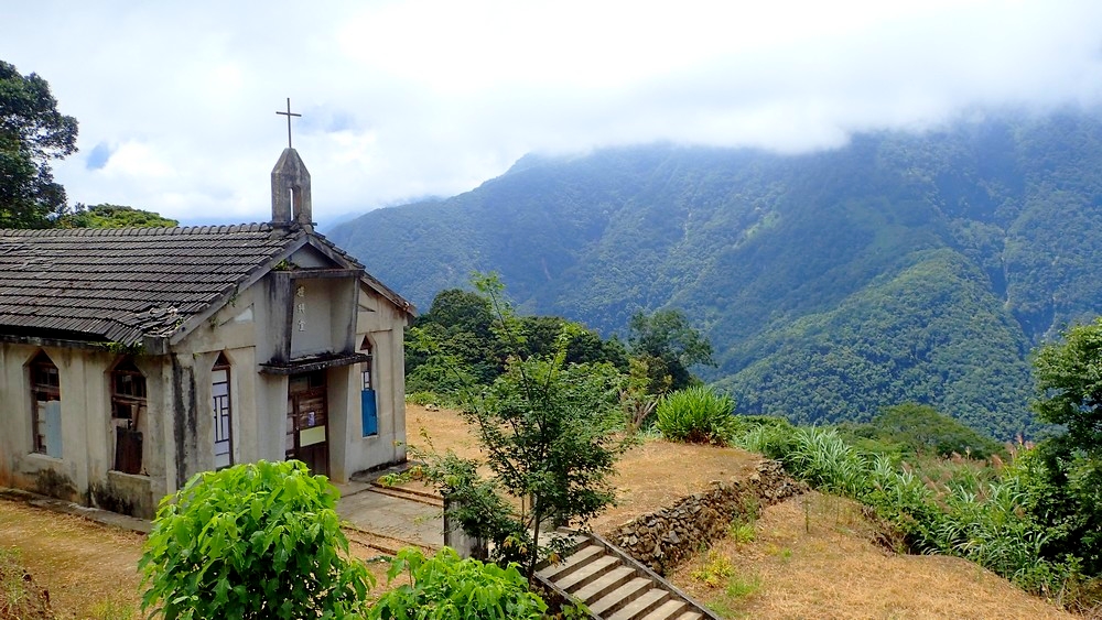
As reaching Dali, your exhausting hike up the mountain in the dense forest will be rewarded with this little mountain abandoned-like village of Dali, where the view is completely stunning. The place is so quiet and relaxing and the abandoned church is surely the best picnic spot to contemplate the clouds dancing on top of the surrounding mountains.


After Dali, you can either go back down to Taroko Visitor Center or keep going to Datong. However, a permit is required past Dali, and since the trail is steep and exhausting, you’d better plan two days to hike this trail and come back.


Beware of wild and dangerous animals such as giant spiders and venomous snakes: I encountered a cobra on my way back and it scared the shit out of me (I learned afterward that Dali’s original name “Xoxos” actually means “place with many snakes”…) In any case, remain calm and leave the scene quickly until the animal leaves the trail.
-
SHAKADANG (4.1 km) (Scenic Trail)
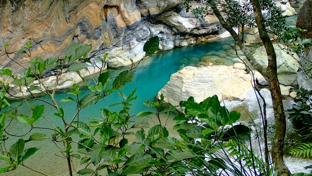
Shakadang trail follows the Shakadang River for about 4 kilometers along its entire length. It’s a very easy walk, mostly flat and maintained with a wooden path. The water of Shakadang’s river is crystal clear, as opposed to the Liwu River which is most of the time greyish. With the yellowish rocks around displaying beautiful folds, the contrast is pretty amazing.


The Shakadang is one of the most famous trails in Taroko, so it’s crowded with tourists most of the time. To avoid the crowd, it’s better to walk it really early in the morning or in the late afternoon when most of the tourist’s buses left the park.
-
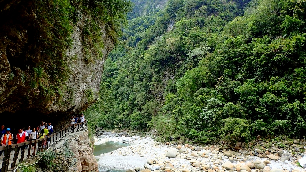
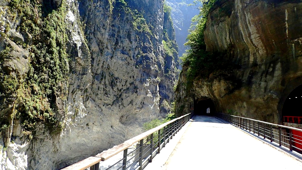
YANZIKOU/SWALLOW GROTTO TRAIL (710 m) (Scenic Trail)
Right after the entrance of the Zhuilu Trail stands the most impressive part of the Taroko National Park: the Yanzikou Trail. Here, the Liwu River narrows and this is without any doubts the most magnificent part of the Taroko Gorge. Its English name “Swallow Grotto” actually comes from the Swallow birds which enjoy gliding their way into the gorge.


The marble gorge is huge here, and while walking along this easy path under the cliffs, you’ll feel as if the mountains are touching the sky – you’ll feel really small down there. I’ve never seen something like this before, the gorge is really impressive and it’s hard to believe how this wonder was created.


After Jingheng Park and the end of the trail, I’ll urge you to keep going and take a look at the gorge and the huge Zhuilu Cliffs further down the road.

-
ZHUILU OLD TRAIL (3.1 km) (Mountaineering Trail)
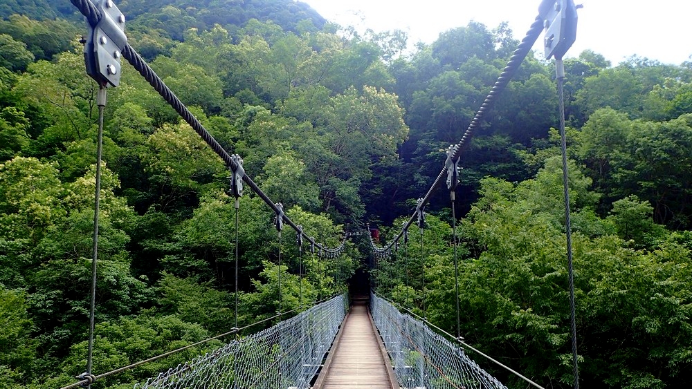
This trail is the most famous hiking trail in Taroko. As so, you need to get a permit to hike, for it’s only limited to 96 people per day, 156 people on holidays. The reason is that the trail is only one meter wide, and goes along the Zhuilu Cliff about 500 meters above the Liwu River. No need to see it’s very much impressive and not suitable for people afraid of heights.


Zhuilu Road was actually built during the Japanese Colonial Period. The police would control the passersby in Taroko area in Badagang, which was an important base at that time: there was a police station, a guesthouse for travellers, and even an aboriginal school. Nowadays, only some pillars and ruins are left from this period, and the hikers are greeted by two huge pillars when entering the remains of the village.


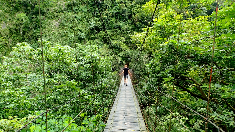
As for the trail, after crossing the most impressive suspension bridge I’ve ever seen, it goes up in the dense forest for about 2 km, passing by Badagang and the Badagang suspension bridge. The trail is super narrow indeed, but it gets a bit scary when you reach the cliff side. For about 1 km, the void is appealing on your left, and the ropes don’t seem to be that much of help in case of a fall. In a tunnel, there’s a little Buddha statue carved on the wall, with offerings from hikers.


The panoramic view from the Zhuilu Cliff is stunning. I was basically up above a gorgeous gorge, and the feeling of vertigo and majestic beauty made me dizzy. It’s surely one of the best views over the National Park.

-
BAIYANG TRAIL (2.1 km) (Scenic Trail)

About 900 m West of Tianxiang along the Central-Cross Island highway, in the Ming Tunnel, you’ll find the entrance to the Baiyang Trail -another tunnel, leading behind the mountain. If you’re afraid of the dark, it’s best if you bring up a torch: there are 8 tunnels on this trail! The trail is mainly flat, like a nice stroll along the river gorge.


The Taci Jili River is running along your side until you reach the little suspension bridge allowing you to see the marvellous Baiyang Waterfall. This waterfall takes its source in the Sanzhan River and comes flushing down the Taci Jili River.


From the viewing deck, the vista is impressive, on one side, the majestic Bayiang Waterfall, that you can spot on different levels in the mountains, and on the other side, the impressive river flow of the Taci Jili River making a thunderous sound. The platform is indeed a hell of a good spot for a picnic before returning exploring Tianxiang.


Please note that the part of the trail leading to the Water Curtain Cave was still closed when I went there, so I don’t have any picture of this curious phenomenon!

-
WENSHAN HOT SPRINGS TRAIL (Trail Closed)
Wenshan Hot Springs
This trail is a bit like a secret trail. You won’t find it on official English maps, neither on the ‘A Walk to Taroko’ guidebook. Like the Liqin Waterfalls trail, it’s known thanks to word-of-mouth. The trail is actually supposed to be closed, since the last bit, which used to be staircase is completely destroyed and it’s a bit dangerous to go down this way. But with extra care, nothing’s impossible, and if your balance sucks like mine, you can just slide down on your butt and everything’s going to be fine.


What awaits you down the Dasha River is a surprise hot springs, a little natural hot pool carved on the cliff wall. Most people there are most probably locals –and most of them are quite old. There are also several little pools for your feet, right beside the river, and it feels super nice to alternate between the cold and hot water. It really smells sulfur down there and reminds me a bit of Rotorua in New Zealand.


Apart from this hot spring, the view from down there is quite amazing, with those bridges and the forest above.
LET’S GO TO THE WENSHAN HOT SPRINGS
SOME OTHER TRAILS WORTH THE WALK
XIAOZHUILU TRAIL (650 m) (Scenic Trail)
Xiaozhuilu
After walking on the Shakadang Trail, you might consider going back to the Visitor Center on foot. In fact, you should consider going on the Xiazhuilu Trail right South on the other side of the Shakadang bridge. You’ll be rewarded with nice views over the Liwu River and there’s a quite nice suspended bridge on the way.


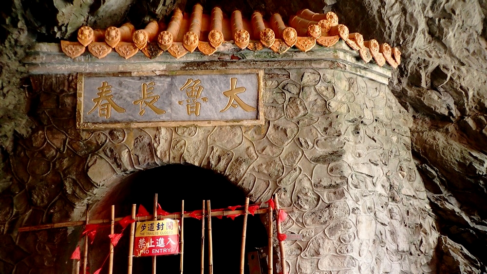
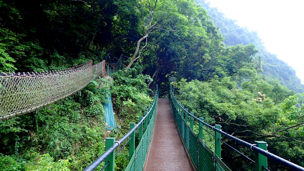
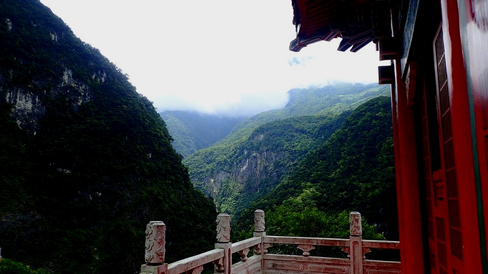
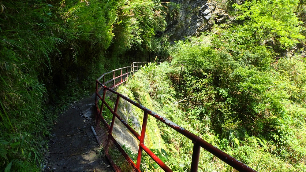
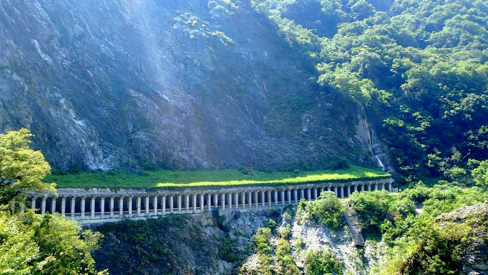
CHANGCHUN SHRINE TRAIL/ETERNAL SPRING SHRINE TRAIL (2 km) (Scenic Trail)

Changchun Shrine was built to commemorate the many workers who died building the Central Cross-Island Highway, which is the Highway connecting the West Coast to the East Coast, from Taichung to Taroko, crossing the Central Mountain Range. The construction began in 1956 but had to be rebuilt multiple times because of collapses, landslides, and rock falls since it’s built on a very unstable terrain: heavy rains from typhoons are causing landslides and the area is also prone to seismic activity. Well, it looks like a doomed road, for which many workers gave their lives while building it or trying to fix it. The shrine was built in 1989, and its peculiarity is that it’s built over a waterfall.


The Changchun Shrine Trail is still under reconstruction, probably due to some landslides or rock falls. Which means that the part leading to the shrine is closed for now. However, the other part of the trail, from the entrance of the Highway to the Bell Tower is still open and is worth a visit. From there, you’ll reach the Changuang Temple, cross a beautiful suspension bridge and walk up to the Bell Tower.


From the Bell Tower, the panoramic view is stunning and leaves me speechless. There’s almost no one around here, and it’s the perfect place to enjoy some mountain quietness –except when the bell rings of course!


Changchun Trail
LIQIN WATERFALLS (Climbing Trail)
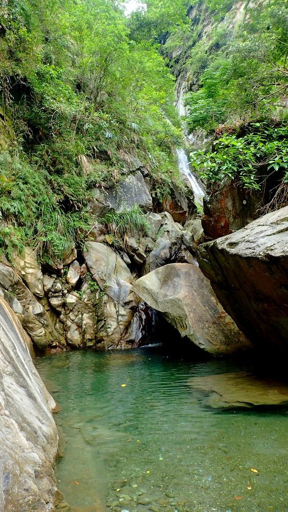
Liqin Waterfalls
Bring a flashlight for this one and pack your bag with shitloads of self-confidence and bravery. You won’t find the way to the Liqin waterfalls on any official Taroko map, and here’s why: there’s no path. Be sure to be prepared to climb up the river to the waterfalls, and DON’T GO ALONE. It’s dangerous and slippery, especially if you’re not trained for this kind of exercise. SO. IT’S BETTER TO GO THERE WITH A QUALIFIED GUIDE.
Okay, so now, that I scared the shit out of you, let’s talk about this hike. After passing through two really dark tunnels full of bats (I know how to say ‘bats’ in Chinese now, while I still can’t order at the restaurant, I can make up my mind between being really proud or ashamed of myself for only remembering useless stuff), you’ll have to climb up the river for about 1 to 3 hours to reach some waterfall’s pools.
Liqin Waterfalls
This trail was really hard for me and my crappy balance – and even though I managed to gather up all the bits of bravery that I have, I still couldn’t make it to the end. My legs were shaking, and my whole body was telling me not to go further. So I stopped at the first pool, letting the other climb to the bigger waterfall. I was angry at myself that I couldn’t push the limits this time, but then I took a swim, sat on a rock, and the sight of the mountains around me in the late afternoon soothed me.


It wasn’t much of a failure, it was still a small victory that I could make it this far. I felt at the top of the world.
LET’S GO TO THE LIQIN WATERFALLS
LÜSHUI TRAIL (2km) (Scenic Trail)
Lushui Trail
The Lüshui Trail goes from Lüshui Terrace to the Heliu campground. It follows the highway, up on the cliff, on an old trail built during the Japanese Era. The trail is mostly flat so suitable for everybody –the kids really seem to like it! On top of that, it’s a very enjoyable walk with shade, a dark tunnel (bring your flashlight if you’re afraid of the dark!), a narrow path with great views over the Liwu River and even a little suspension bridge. If you’re planning to go from Heliu to Lüshui (or the other way around), don’t think twice and walk the trail, you won’t regret it!


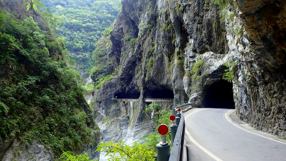
ON THE WAY
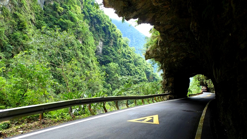
Here are some other marvels that can be found on the way to Tianxiang. Whatever if you’re driving a scooter, a bike, a bicycle, a car, or riding the shuttle bus, the way around Taroko is full of beautiful sights. This is certainly my favorite ride in Taiwan ever, because, between the sight of the gorge, the sight of the mountains, those numerous waterfalls and all those bridges or temples on the way, my heart is clearly delighted by those visions.
EAST ENTRANCE OF TAROKO NATIONAL PARK
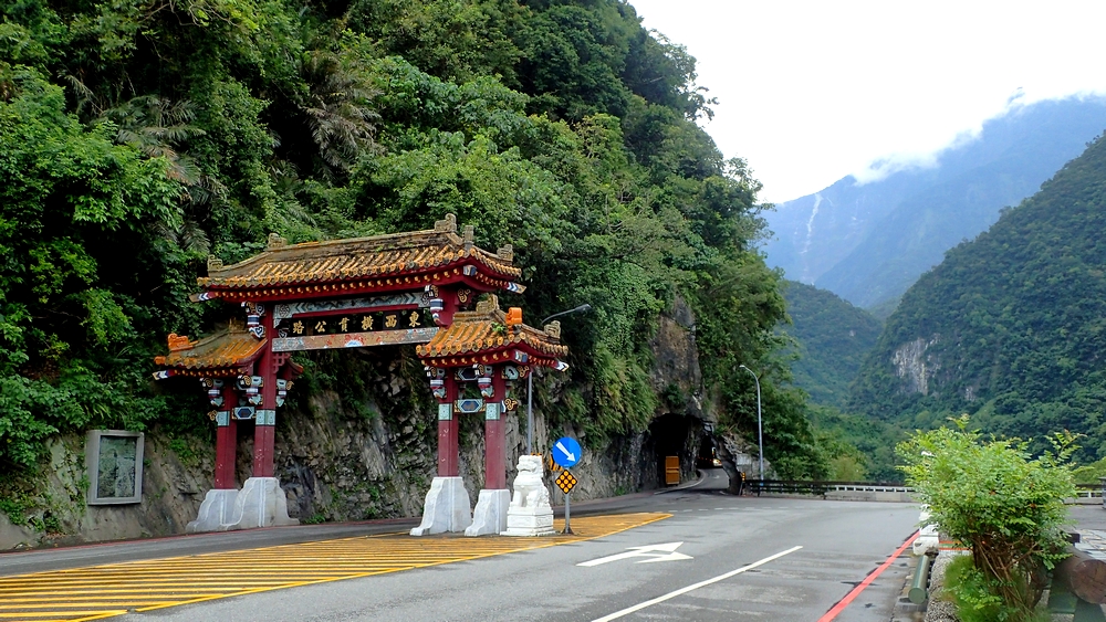
East Entrance
BULUOWAN
Buluowan


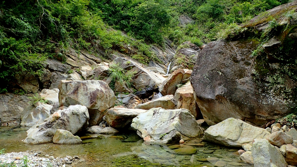
SILVER RIBBON FALLS
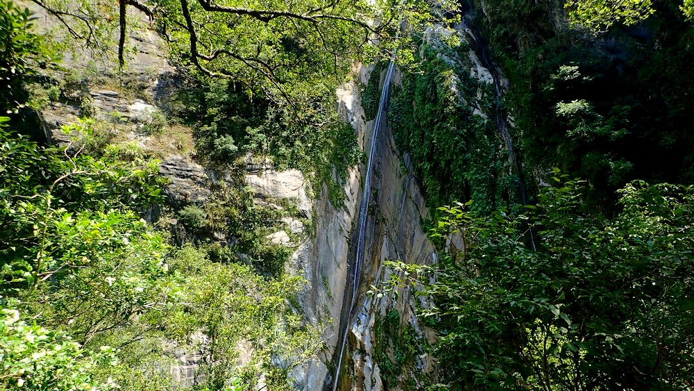
Silver Ribbon Falls
CIMU BRIDGE
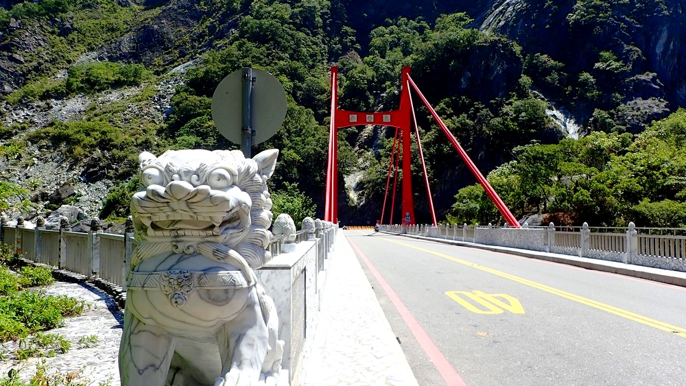
Cimu Bridge
YUEWANG/YUEWEI PAVILION
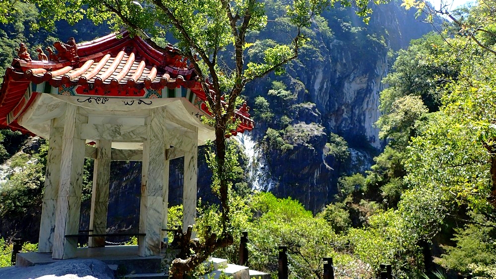
Yuewei Pavilion


TIANXIANG
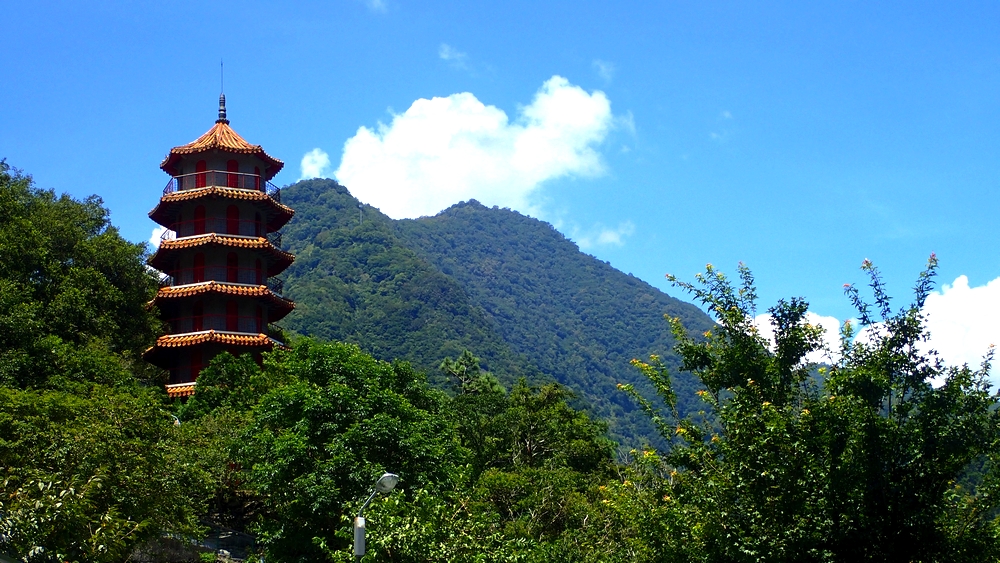
Tianxiang


AROUND TAROKO
QINSHUI CLIFFS – HUIDE SCENIC ROAD (750 meters) (Scenic Trail)
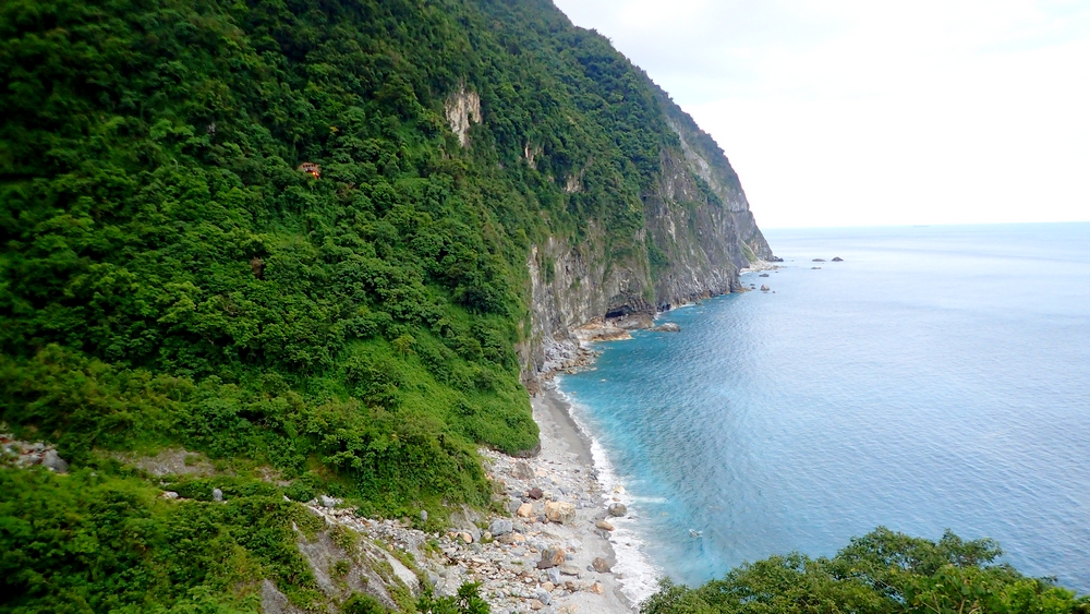
Qinshui Cliffs
Just a few kilometers up north the entrance of Taroko National Park, lies the Qinshui Cliffs, the only part of Taroko that borders the ocean. And WAOW, those cliffs are pretty impressive! From the Huide trail and its viewing platform, you can see one of the most amazing parts of the cliffs. Down under passes the North-Link Railway Line and in front of you, the cliffs seem to stretch as far as the eye can see.


QIXINGTAN/CHIHSHINGTAN BEACH
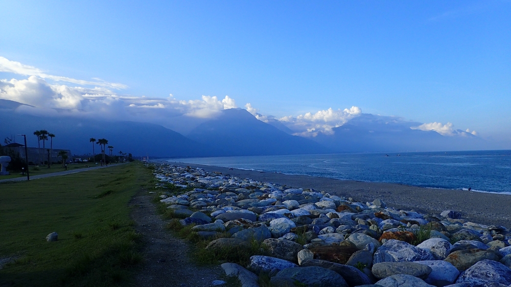
Qixingtan
Shaped like a crescent, Qixingtan beach is one of the most popular and most beautiful beaches around Hualien. The northern coast is located really close to the entrance of the park, and this part is the wildest part of the beach, where no coast guard will whistle you out of the water.
As for the southern part, it’s more touristic for sure, but riding a bike along the coast, between the food stalls and the parks is a very pleasant experience.
The place is also famous for star gazing because the beach is far out of any city, so the light pollution is quite low, which can be rare in Taiwan.


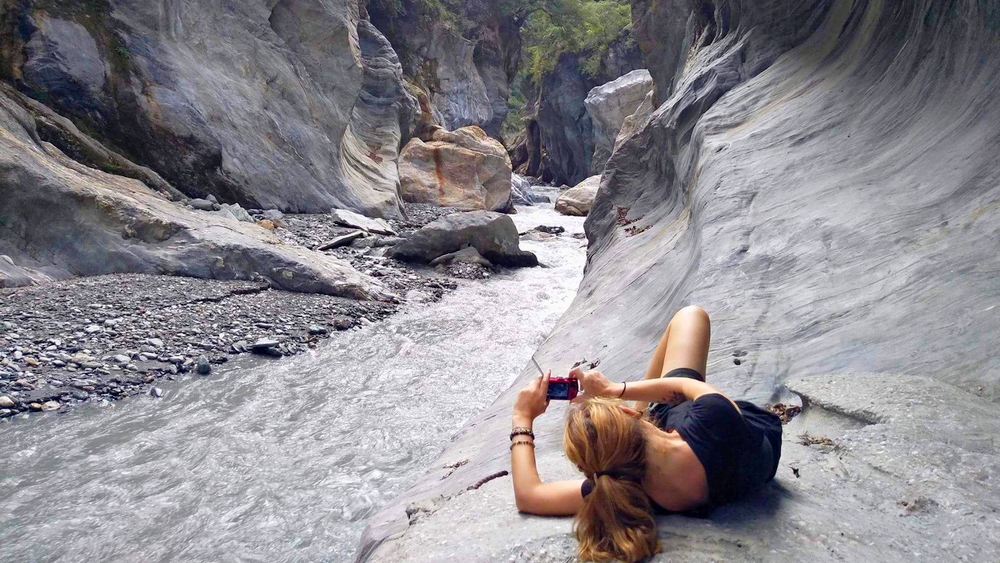
SANZHAN RIVER

Sanzhan River
This is definitely my other favourite place around Hualien. Here the river is pristine blue or deep green, and you can either walk along the river either jump into the fresh water from rocks or even meet some local aborigines. The landscape is truly stunning for the river is winding its way up to the mountains of the Central Mountain Range.
Sanzhan is a tiny little aboriginal village south of Taroko, and it’s the starting point of a famous river tracing hike: the one leading to the Golden Grotto. Beware, though, due to landfalls and so, it’s recommended to go there with an experimented guide.


When I travelled down from Taipei to Hualien, my main reason was that I really wanted more nature, more crazy-wild sceneries and let’s face it: I was craving to go hiking again. I guess this is why I fell in love with Taroko (and the whole Hualien County) right away.
Even though it’s not that easy to travel around without riding a scooter (hey, I’m planning to learn really soon), taking the Shuttle Bus was just fine and couldn’t prevent my heart from singing at the sight of the misty mountains around.
After a few trips to the National Park, I haven’t changed my mind: so far, Taroko is my favorite place in Taiwan and I’d love to spend a lifetime discovering every single trail, every single waterfall, every single mountain. I’ve come to realize that seeking beauty has become my main goal wherever I am, and as Cheryl Strayed way long before me:
“My mom said there’s a sunrise and a sunset every day and you can choose to be there or not. You can put yourself in the way of beauty.”
Well, clearly, this curious way goes through Taroko.
LET’S GO THERE!
RESSOURCES:
A WALK TO TAROKO – Taroko National Park Trails Guide, published by the Taroko National Park, ed. 2016
WORLD INN HOSTEL, Hualien – where my host, Una, took time to advice me about all the Taroko trails.
6 thoughts on “A HIKER’S GUIDE TO TAROKO NATIONAL PARK”
Leave a Reply
Let’s Take a Walk with me!
Salut! * Hello!

Ex-libraire, boulimique d’images et de rêveries en papier. Reconvertie en agent de voyages adepte de nouveaux horizons. Reconvertie en apprentie baroudeuse. Baroudeuse en carton depuis 2015 en Nouvelle-Zélande, au Japon, à Bali, à Singapour, à Taïwan, à Hong-Kong, en Equateur et au Mexique. J’ai chopé la bougeotte et je compte bien ne pas m’arrêter là.
A former bookseller, who couldn’t get enough of pictures and paper dreams. Retrained as a Travel Agent, who couldn’t get enough of new travel inspirations. Retrained as a novice adventurer. Novice Adventurer since 2015 in New Zealand, Japan, Bali, Singapore, Taiwan, Hong-Kong, Ecuador and Mexico. I caught the travel bug and I won’t stop anytime soon.
Let’s take a walk with me!
Pingback:LES TRAINS SONT FAITS POUR PLEURER – Take a Walk on the Wild Side
Pingback:#HANDALONGBOOK – UN CARNET DE VOYAGE FAIT PAR LES VOYAGEURS – Take a Walk on the Wild Side
Pingback:POURQUOI TU DEVRAIS PARLER AUX INCONNUS #6 – LE WORLD INN – Take a Walk on the Wild Side
Pingback:MES BALADES A VELO PREFEREES AUTOUR DE HUALIEN – Take a Walk on the Wild Side
Pingback:CULTURES SAUVAGES #4 -MON PREMIER NOUVEL AN CHINOIS À TAÏWAN – Take a Walk on the Wild Side
Pingback:LA CÔTE EST DE TAIWAN À VÉLO : HISTOIRE D’UNE CYCLISTE EN CARTON – Take a Walk on the Wild Side